The default workflow for creating maps is to customize a map on backend, assign markers to that map and add the related shortcode to your content, example:
[mapsmarker map="1"].
Most map settings can be overwritten by shortcode parameters for further customisation, example:
[mapsmarker map="1" width="100" widthunit="%" tooltip="false"]
For further reference please see the related settings arrays which can be found in /classes/settings.php
Please be aware that marker map shortcodes like [mapsmarker marker="1"] have been depreciated with v4.0 and the parameters below are for overriding regular map shortcodes only!
| Shortcode parameter name | Type | Allowed values | Since version |
| width | absint | * | 4.0 |
| widthUnit | string | %, px | 4.0 |
| height | absint | * | 4.0 |
| heightUnit | string | px | 4.0 |
| lat | float | * | 4.0 |
| lng | float | * | 4.0 |
| zoom | absfloat | 0 – 23 | 4.0 |
| minZoom | absfloat | 0 – 23 | 4.0 |
| maxZoom | absfloat | 0 – 23 | 4.0 |
| zoomStep | absfloat | 0.1 – 1 | 4.0 |
| maxBounds | string | *,* (eg. 14.23432,41.23423) | 4.0 |
| panel | bool | true, false | 4.0 |
| panelColor | string | eg. #ccc | 4.0 |
| panelFs | bool | true, false | 4.0 |
| panelGeoJson | bool | true, false | 4.0 |
| panelKml | bool | true, false | 4.0 |
| panelGeoRss | bool | true, false | 4.0 |
| tabbed | bool | true, false | 4.0 |
| Shortcode parameter name | Type | Allowed values | Since version |
| basemapDetectRetina | bool | true, false | 4.0 |
| basemapEdgeBufferTiles | absint | * | 4.0 |
| basemapGoogleStyles | string | * | 4.0 |
| basemapDefault | string | Please be aware that you can only use values for basemaps here which are defined as available layers for new maps – in the following example only osm and stamenWatercolors would be alllowed values: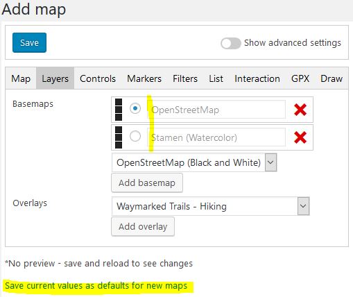
If the set value is not defined as default for new maps, the default basemap is taken, with fallback to osm. List of all possible values: osm, osmBw, OsmDe, osmFrance, osmHot, stamenTerrain, stamenTerrainBackground, stamenTerrainLines, stamenToner, stamenTonerBackground, stamenTonerHybrid, stamenTonerLines, stamenTonerLite, stamenWatercolor, basemapAt, basemapAtSatellite, googleRoadmap, googleSatellite, googleHybrid, googleTerrain, bingRoad, bingAerial, bingAerialLabels, bingCanvasDark, bingCanvasLight, bingCanvasGray, hereNormalDay, hereNormalNight, hereTerrain, hereSatellite, hereHybrid If you are using a custom basemap, you have to give the ID of that basemap as value! |
4.0 |
| Shortcode parameter name | Type | Allowed values | Since version |
| attributionPosition | string | topleft, topright, bottomleft, bottomright | 4.0 |
| attributionCondensed | bool | true, false | 4.0 |
| zoomControlPosition | string | hidden, topleft, topright, bottomleft, bottomright | 4.0 |
| fullscreenPosition | string | hidden, topleft, topright, bottomleft, bottomright | 4.0 |
| resetPosition | string | hidden, topleft, topright, bottomleft, bottomright | 4.0 |
| resetOnDemand | bool | true, false | 4.0 |
| locatePosition | string | hidden, topleft, topright, bottomleft, bottomright | 4.0 |
| locateDrawCircle | bool | true, false | 4.0 |
| locateDrawMarker | bool | true, false | 4.0 |
| locateSetView | string | false, once, always, untilPan, untilPanOrZoom | 4.0 |
| locateKeepCurrentZoomLevel | bool | true, false | 4.0 |
| locateClickBehaviorInView | string | stop, setView | 4.0 |
| locateClickBehaviorOutOfView | string | stop, setView | 4.0 |
| locateIcon | string | icon-cross-hairs, icon-pin, icon-arrow | 4.0 |
| locateMetric | bool | true, false | 4.0 |
| locateShowPopup | bool | true, false | 4.0 |
| locateAutostart | bool | true, false | 4.0 |
| scalePosition | string | hidden, topleft, topright, bottomleft, bottomright | 4.0 |
| scaleMaxWidth | absint | * | 4.0 |
| scaleMetric | bool | true, false | 4.0 |
| scaleImperial | bool | true, false | 4.0 |
| layersPosition | string | hidden, topleft, topright, bottomleft, bottomright | 4.0 |
| layersCollapsed | bool | true, false | 4.0 |
| filtersPosition | string | hidden, topleft, topright, bottomleft, bottomright | 4.0 |
| filtersCollapsed | bool | true, false | 4.0 |
| filtersButtons | bool | true, false | 4.0 |
| filtersName | bool | true, false | 4.0 |
| filtersIcon | bool | true, false | 4.0 |
| filtersCount | bool | true, false | 4.0 |
| filtersOrderBy | string | id, name, count, custom | 4.0 |
| filtersSortOrder | string | asc, desc | 4.0 |
| minimapPosition | string | hidden, topleft, topright, bottomleft, bottomright | 4.0 |
| minimapWidth | absint | * | 4.0 |
| minimapHeight | absint | * | 4.0 |
| minimapCollapsedWidth | absint | * | 4.0 |
| minimapCollapsedHeight | absint | * | 4.0 |
| minimapZoomLevelOffset | floatval | * | 4.0 |
| minimapZoomLevelFixed | int | 0 – 23 | 4.0 |
| minimapMinimized | bool | true, false | 4.0 |
| Shortcode parameter name | Type | Allowed values | Since version |
| markerOpacity | absfloat | 0 – 1 | 4.0 |
| clustering | bool | true, false | 4.0 |
| showCoverageOnHover | bool | true, false | 4.0 |
| disableClusteringAtZoom | absfloat | 0 – 23 | 4.0 |
| maxClusterRadius | absint | * | 4.0 |
| singleMarkerMode | bool | true, false | 4.0 |
| spiderfyDistanceMultiplier | absfloat | * | 4.0 |
| tooltip | bool | true, false | 4.0 |
| tooltipDirection | string | auto, right, left, top, bottom, center | 4.0 |
| tooltipPermanent | bool | true, false | 4.0 |
| tooltipSticky | bool | true, false | 4.0 |
| tooltipOpacity | absfloat | 0.1 – 1 | 4.0 |
| popupOpenOnHover | bool | true, false | 4.0 |
| popupCenterOnMap | bool | true, false | 4.0 |
| popupMarkername | bool | true, false | 4.0 |
| popupAddress | bool | true, false | 4.0 |
| popupCoordinates | bool | true, false | 4.0 |
| popupDirections | bool | true, false | 4.0 |
| popupMinWidth | absint | * | 4.0 |
| popupMaxWidth | absint | * | 4.0 |
| popupMaxHeight | absint | * | 4.0 |
| popupCloseButton | bool | true, false | 4.0 |
| popupAutoClose | bool | true, false | 4.0 |
| Shortcode parameter name | Type | Allowed values | Since version |
| filtersAllMarkers | bool | true, false | 4.0 |
| Shortcode parameter name | Type | Allowed values | Since version |
| list | absint | 0 (= none), 1 (= below), 2 (= right), 3 (= left) | 4.0 |
| listWidth | absint | * | 4.0 |
| listBreakpoint | absint | * | 4.0 |
| listSearch | bool | true, false | 4.0 |
| listIcon | bool | true, false | 4.0 |
| listName | bool | true, false | 4.0 |
| listPopup | bool | true, false | 4.0 |
| listAddress | bool | true, false | 4.0 |
| listDistance | bool | true, false | 4.0 |
| listDistanceUnit | string | metric, imperial, metric-imperial, imperial-metric | 4.0 |
| listDistancePrecision | absint | 0 – 6 | 4.0 |
| listOrderBy | string | id, name, address, distance, icon, created, updated | 4.0 |
| listSortOrder | string | asc, desc | 4.0 |
| listOrderById | bool | true, false | 4.0 |
| listOrderByName | bool | true, false | 4.0 |
| listOrderByAddress | bool | true, false | 4.0 |
| listOrderByDistance | bool | true, false | 4.0 |
| listOrderByIcon | bool | true, false | 4.0 |
| listOrderByCreated | bool | true, false | 4.0 |
| listOrderByUpdated | bool | true, false | 4.0 |
| listLimit | absint | 1 – * | 4.0 |
| listDir | bool | true, false | 4.0 |
| listFs | bool | true, false | 4.0 |
| listAction | string | none, setview, popup | 4.0 |
| Shortcode parameter name | Type | Allowed values | Since version |
| gestureHandling | bool | true, false | 4.0 |
| responsive | bool | true, false | 4.0 |
| dragging | bool | true, false | 4.0 |
| inertia | bool | true, false | 4.0 |
| inertiaDeceleration | absint | 1 – * | 4.0 |
| inertiaMaxSpeed | absint | 1 – * | 4.0 |
| keyboard | bool | true, false | 4.0 |
| keyboardPanDelta | absint | 0 – * | 4.0 |
| scrollWheelZoom | bool | true, false | 4.0 |
| doubleClickZoom | bool | true, false | 4.0 |
| touchZoom | bool | true, false | 4.0 |
| boxZoom | bool | true, false | 4.0 |
| bounceAtZoomLimits | bool | true, false | 4.0 |
| Shortcode parameter name | Type | Allowed values | Since version |
| gpxUrl | string | * | 4.0 |
| gpxMeta | bool | true, false | 4.0 |
| gpxMetaUnits | string | metric, imperial, metric-imperial, imperial-metric | 4.0 |
| gpxMetaInterval | absint | 0 – * | 4.0 |
| gpxMetaName | bool | true, false | 4.0 |
| gpxMetaStart | bool | true, false | 4.0 |
| gpxMetaEnd | bool | true, false | 4.0 |
| gpxMetaTotal | bool | true, false | 4.0 |
| gpxMetaMoving | bool | true, false | 4.0 |
| gpxMetaDistance | bool | true, false | 4.0 |
| gpxMetaPace | bool | true, false | 4.0 |
| gpxMetaHeartRate | bool | true, false | 4.0 |
| gpxMetaElevation | bool | true, false | 4.0 |
| gpxMetaDownload | bool | true, false | 4.0 |
| gpxIcons | bool | true, false | 4.0 |
| gpxTrackSmoothFactor | absfloat | 0 – * | 4.0 |
| gpxTrackColor | string | e.g. #ccc | 4.0 |
| gpxTrackWeight | absfloat | 0 – * | 4.0 |
| gpxTrackOpacity | absfloat | 0 . * | 4.0 |
| gpxWaypoints | bool | true, false | 4.0 |
| gpxWaypointsRadius | absint | 0 – * | 4.0 |
| gpxWaypointsStroke | bool | true, false | 4.0 |
| gpxWaypointsColor | string | e.g. #ccc | 4.0 |
| gpxWaypointsWeight | absint | 0 – * | 4.0 |
| gpxWaypointsFillColor | string | e.g. #ccc | 4.0 |
| gpxWaypointsFillOpacity | absfloat | 0 – * | 4.0 |
| gpxChart | bool | true, false | 4.0 |
| gpxChartHeight | absint | 0 – * | 4.0 |
| gpxChartBgColor | string | e.g. #ccc | 4.0 |
| gpxChartPolyline | bool | true, false | 4.0 |
| gpxChartPolylineColor | string | e.g. #ccc | 4.0 |
| gpxChartPolylineWeight | absint | 0 – * | 4.0 |
| gpxChartPolygon | bool | true, false | 4.0 |
| gpxChartPolygonFillColor | string | e.g. #ccc | 4.0 |
| gpxChartIndicator | bool | true, false | 4.0 |
| gpxChartIndicatorColor | string | e.g. #ccc | 4.0 |
| gpxChartIndicatorWeight | absint | 0 – * | 4.0 |
| gpxChartLocator | bool | true, false | 4.0 |
| gpxChartLocatorRadius | absint | 0 – * | 4.0 |
| gpxChartLocatorStroke | bool | true, false | 4.0 |
| gpxChartLocatorColor | string | e.g. #ccc | 4.0 |
| gpxChartLocatorWeight | absint | 0 – * | 4.0 |
| gpxChartLocatorFillColor | string | e.g. #ccc | 4.0 |
| gpxChartLocatorFillOpacity | absfloat | 0 – * | 4.0 |