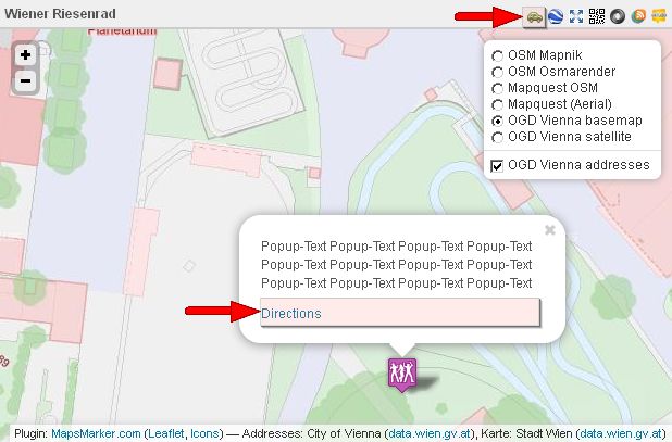
I am glad to announce, that the often requested feature for directions has now found its way into version 1.4 of Leaflet Maps Marker. Now you can not only show your locations to your website visitors, but also give them directions on how to best get there by car/bike/foot, sample screenshot:

For a live demo please see the demo maps on the frontpage of www.mapsmarker.com.
In the plugin settings area there is now a new tab called directions, where you can configure which directions provider you want to use for your map:

Although I would prefer OpenStreetMap routing, I set Google Maps as default, as it delivers the highest usability (get location via HTML5, least clicks needed to display route information and more). If you live in Europe, you might want to try openrouteservice.org, which also delivers a good usability and is based on OpenStreetMap data. Anyway you can choose different routing options for each provider (prefered transportation type…) for each provider in settings / directions.
The directions link gets added by default to the API panel (see the car on the map above) and by default the link “Directions” (please also see the map above) also gets attached to the popup text on each marker. Both settings can be disabled if you don´t want to show the directions link to your users (API panel link via settings / Marker defaults; Popup-text via settings / Directions).
New mass actions
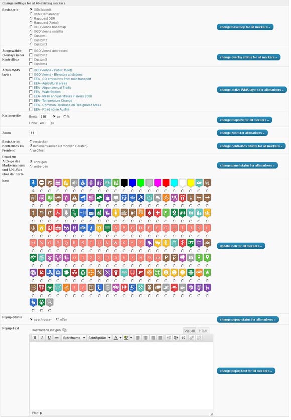
Another new feature which made it into v1.4 are new mass-actions for all existing markers. Via “Tool” you can now change all settings for all existing markers, including basemap, overlays, wms, icon, mapsize, popuptext, popup status and more:

Bugfixes
v1.4 also includes some bugfixes for layout issues and configuration problem on some hosts leading to markers not being saved to database or API links not working.
Full changelog
Please let me what you think of this new release. If you have any issues, please see this page on how to get support. If an important feature is missing, please add your feature requests on Github. I am also looking for more translations – if you would like to contribute a new one, please visit this page for more information.